Situated at Regional Road 25 and 15 Sideroad, halfway between Acton and Milton, the historic settlement of Speyside was once a bustling village of high expectations.
Carved out among the tall trees and rock that sat atop the Niagara Escarpment, the early Scottish settlers of the 1820s were mostly attracted to the area because of the creek that tumbled over the rocks, creating a miniature waterfall. Reminding them of home, the settlers decided to name the area Speyside in honour of the River Spey in Scotland.
Upon realization of its natural features, of a powerful creek, towering trees and the abundance of valuable limestone, it was not long before the settlers established the first industries of Speyside with a sawmill and quarry.
Over the ensuing years that followed, Speyside enjoyed much prosperity and success as an industrial village. It was from the quarry in Speyside that the limestone was used, in 1868, to build the Scotch Block’s Boston Presbyterian Church on the Third Line. The village also became a reputable farming community for growing grain hops, used for the brewing of beer, thanks to the area’s fertile and arable soil.
It was between the 1850s and 1870s when Speyside was at its height of an economic boom as it had a hotel, known as the Stewart Hotel, two general stores, a blacksmith, a village hall, two sawmills, a tannery, and a quarry. By 1873, the population of Speyside was listed at 200, which warranted the opening of a post office, located at the southeast corner of Regional Road 25 and 15 Sideroad, and the construction of schoolhouse S.S. #10 Dufferin, one mile south of the village below St. Helena Road.
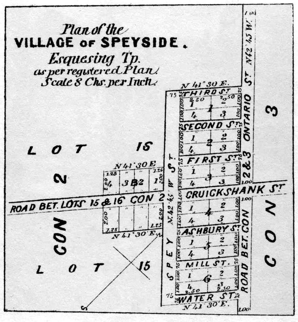
As indicated in the Halton County Atlas of 1877, it was expected that Speyside would continue to grow as plans for streets and lots were laid out, although that never came to fruition. Due to the attractiveness of jobs and housing in the neighbouring communities of Acton and Georgetown, industry in Speyside began to dry up as people moved out. By 1908, the population declined to a staggering 40 residents and by 1914, the post office was shuttered.
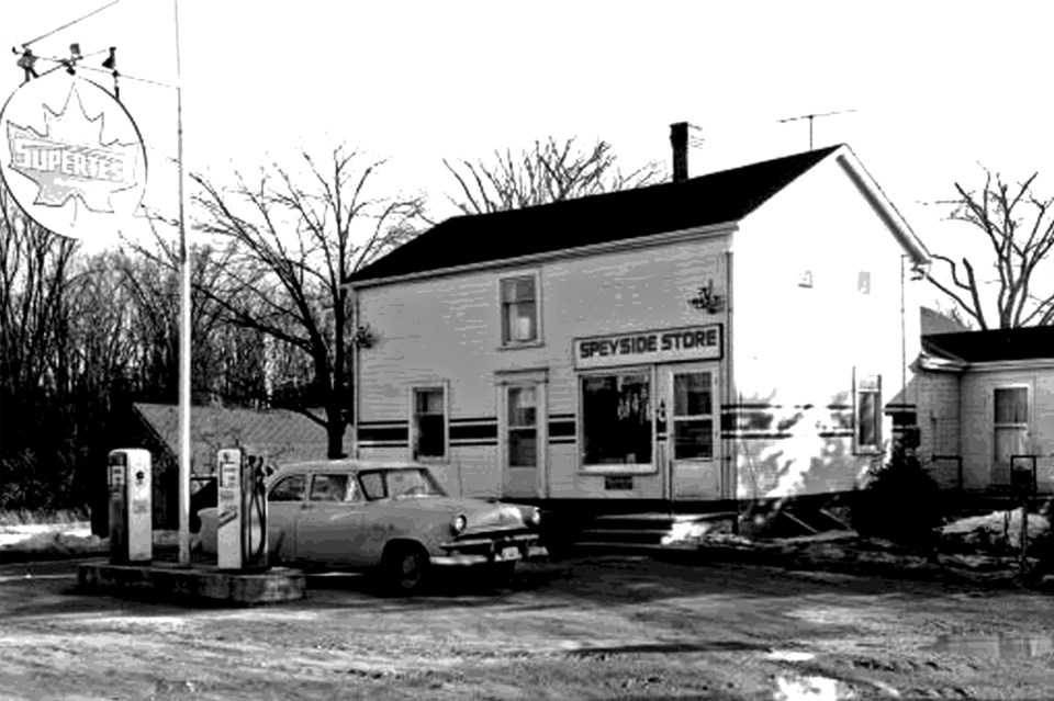
Even with the decline in population, the general store, located at the southwest corner of Regional Road 25 and 15 Sideroad, remained open to continue serving residents and the drivers who made their way along the highway until closing in the late 2000s. It was moved back 17 feet to accommodate the widening of the highway in 1942.
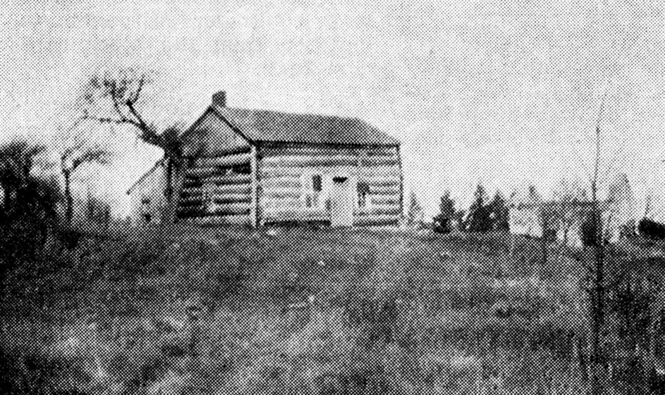
Dufferin School continued to provide education to the local children until a decision was made to close the old schoolhouse and move them to a newly-constructed central school, named Speyside Public School, in 1960. The old schoolhouse was converted into a private residence.
The new school, situated north of Speyside at 17 Sideroad, served the children who lived in the rural area. Speyside School would operate for a quarter-century until the Halton District School Board announced its closure in June 1986 due to low enrollment and cost-saving measures. The building now sits vacant under private ownership.
While the deteriorating structures of the former general store and school are all that visibly remain, the historic settlement of Speyside is remembered as a bustling village that once showed economic prosperity inspired by the natural landscape that attracted settlers to the area over 200 years ago.
Article written by Scott Brooks, with information from Dills Collection/HHPL/EHS/Halton’s Pages of the Past/Halton County Atlas of 1877.


