Throughout Canada, there are a number of communities, towns and settlements that are situated on or near a border. Most famously, and better known, is Lloydminster, which is a city that has the unusual geographic distinction of straddling the provincial border between Alberta and Saskatchewan. When looking closer to home, Halton Hills also has a couple of communities that are divided by boundaries - Ballinafad and Crewsons Corners.
Ballinafad, situated at the intersection of Trafalgar Road and 32 Sideroad, sits directly on the Erin (Wellington County) and Halton Hills (Halton Region) border. The historic hamlet was settled in November 1820, on Lot 1, Concession 7 in Erin Township, by Nathaniel, George and Eldrich Roszell. By the spring of 1821, more settlers came to the area, which saw Joseph Hilts and Sarah Johnson take up residency on the Esquesing Township (Halton Hills) side of the new settlement.
Soon, the hamlet grew as Trafalgar Road would become a major artery that early settlers utilized to transport goods down to the harbour in Oakville. As for the naming of this settlement, Thomas Merry is credited with bestowing the name Ballinafad, in honour of his hometown in Ireland.
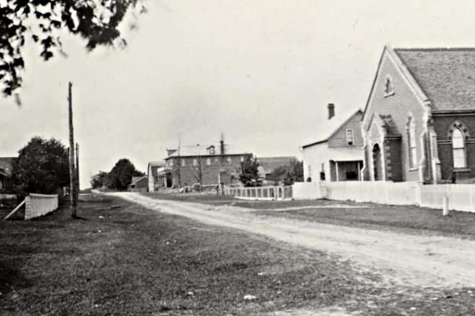
At the hamlet’s height, Ballinafad was a bustling place consisting of two schools for Erin and Esquesing, two churches, a general store and post office, hotels and a blacksmith shop.
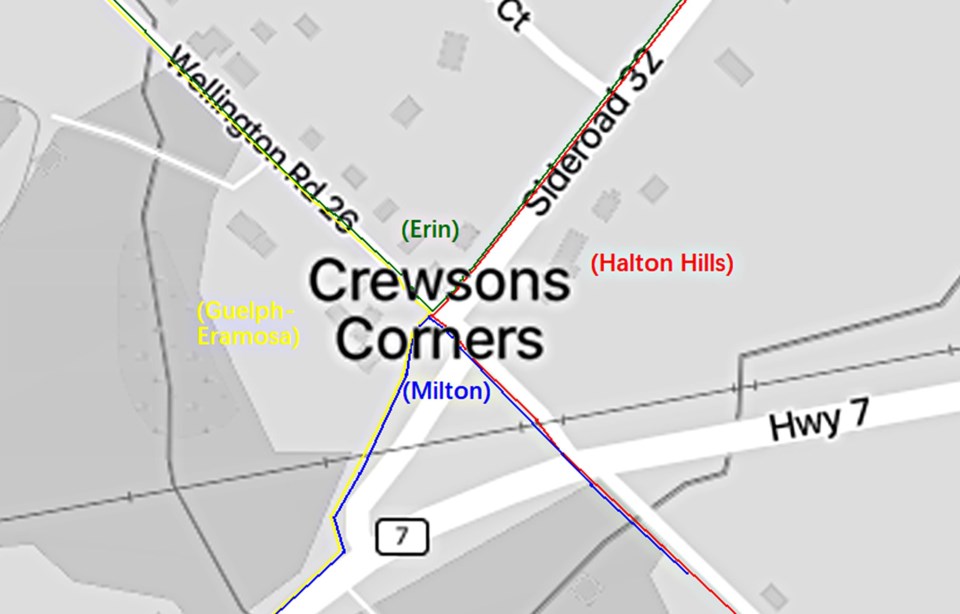
As for Crewsons Corners, it’s a historic community situated four kilometres west of Acton on 32 Sideroad and uniquely sits in two counties (Wellington and Halton) and is divided by the four municipalities of Halton Hills, Milton, Guelph-Eramosa and Erin. The settlement was originally known as Ryckman's Corner, named after surveyor Samuel Ryckman who surveyed the area of Eramosa and Nassagawaeya in 1819.
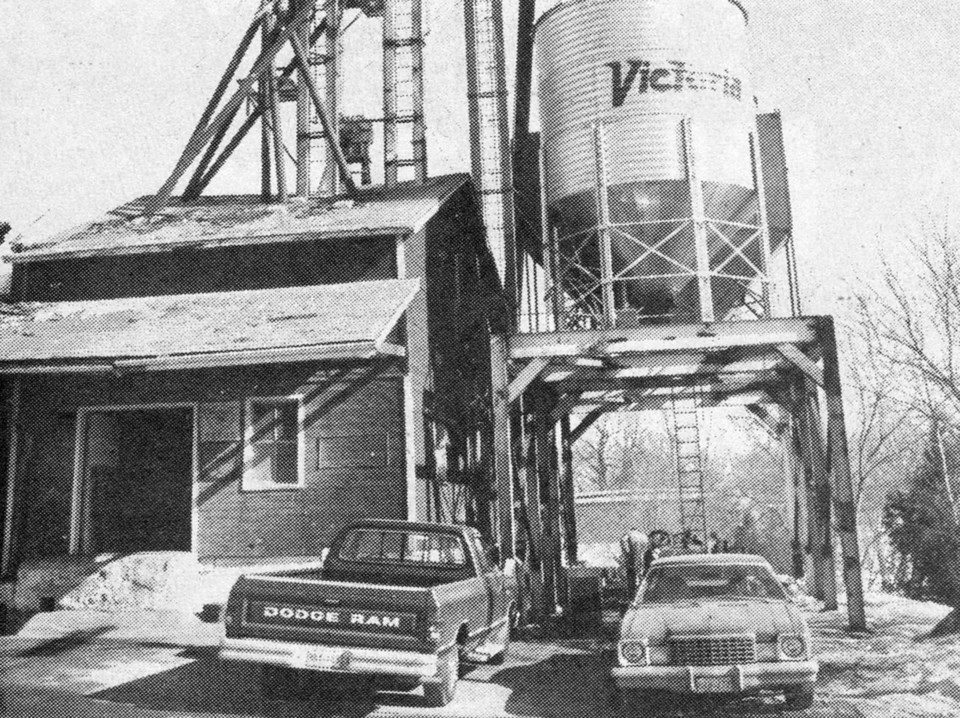
The area was renamed in 1825 when Morgan Crewson and his family, of Pennsylvania, purchased the land in both Esquesing and Erin Townships. At its peak, similar to Ballinafad, Crewsons Corners was an active farming community consisting of a general store, post office, Methodist Church, a succession of schools, a brickyard, sawmill and even a small tannery - all conveniently situated next to the York to Guelph Road, an early predecessor to Highway 7.
While both Ballinafad and Crewsons Corners did enjoy early success, the arrival of the Grand Trunk Railway in 1856 would seal their fate as this new mode of transportation bypassed the two communities and made shipping of goods by buggy virtually obsolete, eventually leading to economic decline due to a lack of road travellers. Crewsons Corners was right next to the tracks, but was ineligible for a train stop as it was considered too close to the station in Acton.
Despite being cut off by the train service, both communities would continue to function in some capacity, for many years, with Ballinafad having a church, general store and feed mill, and Crewsons Corners being home to a church, post office and dance hall; the latter being owned and operated by Tony Seynuck, a local bootlegger of beer and a discoverer of natural gas in Esquesing Township in the first half of the 20th century.
While Ballinafad and Crewsons Corners are no longer places of economic activity, they do hold a special place as historic settlements that helped shape the area and have the unique distinction of being the border communities of present-day Halton Hills.
Article written by Scott Brooks, with information from Dills Collection/EHS/HHPL.


